Ecuador - Introduction

Ecuador (officially: Republic of Ecuador) is a country in Americas, precisely in South America, with a population of about 18.4 Millions inhabitants today (2024-06-25). The capital city of Republic of Ecuador is Quito, and the official country TLD code is .ec. Ecuador has cca2, cca3, cioc, ccn3 codes as EC, ECU, ECU, 218 respectively. Check some other vital information below.

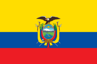
Ecuador , Coat of Arms
Names
Common Ecuador
Official Republic of Ecuador
Common (Native) Ecuador
Official (Native) Republic of Ecuador
Alternative spellings EC, Republic of Ecuador, República del Ecuador
Translations ⬇️
Languages
spa Spanish
Geography
User Country Flag

Flag

Ecuador is located in South America and has a total land area of 276841 km². It is bounded by Colombia, Peru and the capital city is Quito

Region/Continent South America
Subregion South America
TimeZone UTC-06:00UTC-05:00
Capital city Quito
Area 276841 km²
Population 2024-06-25 18.4 Millions
Bordered Countreies Colombia, Peru
Demonym
eng Male: Ecuadorean / Female: Ecuadorean
fra Male: Équatorien / Female: Équatorienne
Lat/Lng -2, -77.5
Historical data and more
The National Flag of Ecuador

The flag of Ecuador is composed of the horizontal bands of yellow, blue and red, with the yellow band twice the height of the other two bands. The Ecuadorian coat of arms is superimposed in the center of the field.

Historyedit

Pre-Inca eraedit

Various peoples had settled in the area of future Ecuador before the arrival of the Incas. The archeological evidence suggests that the Paleo-Indians' first dispersal into the Americas occurred near the end of the last glacial period, around 16,500–13,000 years ago. The first people who reached Ecuador may have journeyed by land from North and Central America or by boat down the Pacific Ocean coastline.

Even though their languages were unrelated, these groups developed similar groups of cultures, each based in different environments. The people of the coast combined agriculture with fishing, hunting, and gathering; the people of the highland Andes developed a sedentary agricultural way of life; and peoples of the Amazon basin relied on hunting and gathering, in some cases combined with agriculture and arboriculture.

Many civilizations arose in Ecuador, such as the Valdivia Culture and Machalilla Culture on the coast, the Quitus (near present-day Quito), and the Cañari (near present-day Cuenca).

In the highland Andes mountains, where life was more sedentary, groups of tribes cooperated and formed villages; thus the first nations based on agricultural resources and the domestication of animals formed. Eventually, through wars and marriage alliances of their leaders, groups of nations formed confederations.

When the Incas arrived, they found that these confederations were so developed that it took the Incas two generations of rulers—Topa Inca Yupanqui and Huayna Capac—to absorb them into the Inca Empire. People belonging to the confederations that gave them the most problems were deported to distant areas of Peru, Bolivia, and north Argentina. Similarly, a number of loyal Inca subjects from Peru and Bolivia were brought to Ecuador to prevent rebellion. Thus, the region of highland Ecuador became part of the Inca Empire in 1463 sharing the same language.

In contrast, when the Incas made incursions into coastal Ecuador and the eastern Amazon jungles of Ecuador, they found both the environment and indigenous people more hostile. Moreover, when the Incas tried to subdue them, these indigenous people withdrew to the interior and resorted to guerrilla tactics. As a result, Inca expansion into the Amazon Basin and the Pacific coast of Ecuador was hampered. The indigenous people of the Amazon jungle and coastal Ecuador remained relatively autonomous until the Spanish soldiers and missionaries arrived in force. The Amazonian people and the Cayapas of Coastal Ecuador were the only groups to resist both Inca and Spanish domination, maintaining their languages and cultures well into the 21st century.

Before the arrival of the Spaniards, the Inca Empire was involved in a civil war. The untimely death of both the heir Ninan Cuyochi and the Emperor Huayna Capac, from a European disease that spread into Ecuador, created a power vacuum between two factions and led to a civil war. The army stationed north headed by Atahualpa marched south to Cuzco and massacred the royal family associated with his brother. In 1532, a small band of Spaniards headed by Francisco Pizarro reached Cajamarca and lured Atahualpa into a trap (battle of Cajamarca). Pizarro promised to release Atahualpa if he made good his promise of filling a room full of gold. But, after a mock trial, the Spaniards executed Atahualpa by strangulation.

Spanish colonizationedit

New infectious diseases such as smallpox, endemic to the Europeans, caused high fatalities among the Amerindian population during the first decades of Spanish rule, as they had no immunity. At the same time, the natives were forced into the encomienda labor system for the Spanish. In 1563, Quito became the seat of a real audiencia (administrative district) of Spain and part of the Viceroyalty of Peru and later the Viceroyalty of New Granada.

The 1797 Riobamba earthquake, which caused up to 40,000 casualties, was studied by Alexander von Humboldt, when he visited the area in 1801–1802.

After nearly 300 years of Spanish rule, Quito still remained small with a population of 10,000 people. On 10 August 1809, the city's criollos called for independence from Spain (first among the peoples of Latin America). They were led by Juan Pío Montúfar, Quiroga, Salinas, and Bishop Cuero y Caicedo. Quito's nickname, "Luz de América" ("Light of America"), is based on its leading role in trying to secure an independent, local government. Although the new government lasted no more than two months, it had important repercussions and was an inspiration for the independence movement of the rest of Spanish America. Today, 10 August is celebrated as Independence Day, a national holiday.

Independenceedit

On 9 October 1820, the Department of Guayaquil became the first territory in Ecuador to gain its independence from Spain, and it spawned most of the Ecuadorian coastal provinces, establishing itself as an independent state. Its inhabitants celebrated what is now Ecuador's official Independence Day on 24 May 1822. The rest of Ecuador gained its independence after Antonio José de Sucre defeated the Spanish Royalist forces at the Battle of Pichincha, near Quito. Following the battle, Ecuador joined Simón Bolívar's Republic of Gran Colombia, also including modern-day Colombia, Venezuela, and Panama. In 1830, Ecuador separated from Gran Colombia and became an independent republic. Two years later, it annexed the Galapagos Islands.

The 19th century was marked by instability for Ecuador with a rapid succession of rulers. The first president of Ecuador was the Venezuelan-born Juan José Flores, who was ultimately deposed. Leaders who followed him included Vicente Rocafuerte; José Joaquín de Olmedo; José María Urbina; Diego Noboa; Pedro José de Arteta; Manuel de Ascásubi; and Flores's own son, Antonio Flores Jijón, among others. The conservative Gabriel García Moreno unified the country in the 1860s with the support of the Roman Catholic Church. In the late 19th century, world demand for cocoa tied the economy to commodity exports and led to migrations from the highlands to the agricultural frontier on the coast.

Ecuador abolished slavery in 1851. The descendants of enslaved Ecuadorians are among today's Afro-Ecuadorian population.

Liberal Revolutionedit

The Liberal Revolution of 1895 under Eloy Alfaro reduced the power of the clergy and the conservative land owners. This liberal wing retained power until the military "Julian Revolution" of 1925. The 1930s and 1940s were marked by instability and emergence of populist politicians, such as five-time President José María Velasco Ibarra.

Loss of claimed territories since 1830edit

After Ecuador's separation from Colombia on 13 May 1830, its first President, General Juan José Flores, laid claim to the territory that had belonged to the Real Audiencia of Quito, also referred to as the Presidencia of Quito. He supported his claims with Spanish Royal decrees, or real cedulas, that delineated the borders of Spain's former overseas colonies. In the case of Ecuador, Flores based Ecuador's de jure claims on the Real Cedulas of 1563, 1739, and 1740; with modifications in the Amazon Basin and Andes Mountains that were introduced through the Treaty of Guayaquil (1829) which Peru reluctantly signed, after the overwhelmingly outnumbered Gran Colombian force led by Antonio José de Sucre defeated President and General La Mar's Peruvian invasion force in the Battle of Tarqui. In addition, Ecuador's eastern border with the Portuguese colony of Brazil in the Amazon Basin was modified before the Wars of Independence by the First Treaty of San Ildefonso (1777) between the Spanish Empire and the Portuguese Empire. Moreover, to add legitimacy to his claims, on 16 February 1840, Flores signed a treaty with Spain, whereby Flores convinced Spain to officially recognize Ecuadorian independence and its sole rights to colonial titles over Spain's former colonial territory known anciently to Spain as the Kingdom and Presidency of Quito.

Ecuador during its long and turbulent history has lost most of its contested territories to each of its more powerful neighbors, such as Colombia in 1832 and 1916, Brazil in 1904 through a series of peaceful treaties, and Peru after a short war in which the Protocol of Rio de Janeiro was signed in 1942.

Struggle for independenceedit

During the struggle for independence, before Peru or Ecuador became independent, areas of the former Vice Royalty of New Granada declared themselves independent from Spain. A few months later, a part of the Peruvian liberation army of San Martín decided to occupy the independent cities of Tumbez and Jaén, with the intention of using them as springboards to occupy the independent city of Guayaquil and then liberate the rest of the Audiencia de Quito (Ecuador). It was common knowledge among officers of the liberation army from the south that their leader San Martín wished to liberate present-day Ecuador and add it to the future republic of Peru, since it had been part of the Inca Empire before the Spaniards conquered it. However, Bolívar's intention was to form a new republic known as the Gran Colombia, out of the liberated Spanish territory of New Granada which consisted of Colombia, Venezuela, and Ecuador. San Martín's plans were thwarted when Bolívar, descended from the Andes mountains and occupied Guayaquil; they also annexed the newly liberated Audiencia de Quito to the Republic of Gran Colombia.

In the south, Ecuador had claims to a small piece of land beside the Pacific Ocean known as Tumbes. In Ecuador's southern Andes Mountain region where the Marañon cuts across, Ecuador had claims to an area it called Jaén de Bracamoros. These areas were included as part of the territory of Gran Colombia by Bolivar on 17 December 1819, during the Congress of Angostura when the Republic of Gran Colombia was created. Tumbes declared itself independent from Spain on 17 January 1821, and Jaén de Bracamoros on 17 June 1821, without any outside help from revolutionary armies. However, that same year, Peruvian forces participating in the Trujillo revolution occupied both Jaén and Tumbes. Peruvian generals, without any legal titles backing them up and with Ecuador still federated with the Gran Colombia, had the desire to annex Ecuador to the Republic of Peru at the expense of the Gran Colombia, feeling that Ecuador was once part of the Inca Empire.

On 28 July 1821, Peruvian independence was proclaimed in Lima by San Martín, and Tumbes and Jaén, which were included as part of the revolution of Trujillo by the Peruvian occupying force, had the whole region swear allegiance to the new Peruvian flag and incorporated itself into Peru. Gran Colombia had always protested Peru for the return of Jaén and Tumbes for almost a decade, then finally Bolivar after long and futile discussion over the return of Jaén, Tumbes, and part of Mainas, declared war. President and General José de La Mar, who was born in Ecuador, believing his opportunity had come to annex the District of Ecuador to Peru, personally, with a Peruvian force, invaded and occupied Guayaquil and a few cities in the Loja region of southern Ecuador on 28 November 1828.

The war ended when an outnumbered southern Gran Colombian army at Battle of Tarqui on 27 February 1829, led by Antonio José de Sucre, defeated the Peruvian invasion force led by President La Mar. This defeat led to the signing of the Treaty of Guayaquil in September 1829, whereby Peru and its Congress recognized Gran Colombian rights over Tumbes, Jaén, and Maynas. Through meetings between Peru and Gran Colombia, the border was set as Tumbes river in the west, and in the east, the Maranon and Amazon rivers were to be followed toward Brazil as the most natural borders between them. According to the peace negotiations Peru agreed to return Guayaquil, Tumbez, and Jaén; despite this, Peru returned Guayaquil, but failed to return Tumbes and Jaén, alleging that it was not obligated to follow the agreements, since the Gran Colombia ceased to exist when it divided itself into three different nations – Ecuador, Colombia, and Venezuela.

The Central District of the Gran Colombia, known as Cundinamarca or New Granada (modern Colombia) with its capital in Bogota, did not recognize the separation of the Southern District of the Gran Colombia, with its capital in Quito, from the Gran Colombian federation on 13 May 1830. After Ecuador's separation, the Department of Cauca voluntarily decided to unite itself with Ecuador due to instability in the central government of Bogota. The Venezuelan born President of Ecuador, the general Juan José Flores, with the approval of the Ecuadorian congress annexed the Department of Cauca on 20 December 1830, since the government of Cauca had called for union with the District of the South as far back as April 1830. Moreover, the Cauca region, throughout its long history, had very strong economic and cultural ties with the people of Ecuador. Also, the Cauca region, which included such cities as Pasto, Popayán, and Buenaventura, had always been dependent on the Presidencia or Audiencia of Quito.

Fruitless negotiations continued between the governments of Bogotá and Quito, where the government of Bogotá did not recognize the separation of Ecuador or that of Cauca from the Gran Colombia until war broke out in May 1832. In five months, New Granada defeated Ecuador due to the fact that the majority of the Ecuadorian Armed Forces were composed of rebellious angry unpaid veterans from Venezuela and Colombia that did not want to fight against their fellow countrymen. Seeing that his officers were rebelling, mutinying, and changing sides, President Flores had no option but to reluctantly make peace with New Granada. The Treaty of Pasto of 1832 was signed by which the Department of Cauca was turned over to New Granada (modern Colombia), the government of Bogotá recognized Ecuador as an independent country and the border was to follow the Ley de División Territorial de la República de Colombia (Law of the Division of Territory of the Gran Colombia) passed on 25 June 1824. This law set the border at the river Carchi and the eastern border that stretched to Brazil at the Caquetá river. Later, Ecuador contended that the Republic of Colombia, while reorganizing its government, unlawfully made its eastern border provisional and that Colombia extended its claims south to the Napo River because it said that the Government of Popayán extended its control all the way to the Napo River.

Struggle for possession of the Amazon Basinedit

When Ecuador seceded from the Gran Colombia, Peru contested Ecuador's claims with the newly discovered Real Cedula of 1802, by which Peru claims the King of Spain had transferred these lands from the Viceroyalty of New Granada to the Viceroyalty of Peru. During colonial times this was to halt the ever-expanding Portuguese settlements into Spanish domains, which were left vacant and in disorder after the expulsion of Jesuit missionaries from their bases along the Amazon Basin. Ecuador countered by labeling the Cedula of 1802 an ecclesiastical instrument, which had nothing to do with political borders. Peru began its de facto occupation of disputed Amazonian territories, after it signed a secret 1851 peace treaty in favor of Brazil. This treaty disregarded Spanish rights that were confirmed during colonial times by a Spanish-Portuguese treaty over the Amazon regarding territories held by illegal Portuguese settlers.

Peru began occupying the missionary villages in the Mainas or Maynas region, which it began calling Loreto, with its capital in Iquitos. During its negotiations with Brazil, Peru claimed Amazonian Basin territories up to Caqueta River in the north and toward the Andes Mountain range. Colombia protested stating that its claims extended south toward the Napo and Amazon Rivers. Ecuador protested that it claimed the Amazon Basin between the Caqueta river and the Marañon-Amazon river. Peru ignored these protests and created the Department of Loreto in 1853 with its capital in Iquitos. Peru briefly occupied Guayaquil again in 1860, since Peru thought that Ecuador was selling some of the disputed land for development to British bond holders, but returned Guayaquil after a few months. The border dispute was then submitted to Spain for arbitration from 1880 to 1910, but to no avail.

In the early part of the 20th century, Ecuador made an effort to peacefully define its eastern Amazonian borders with its neighbours through negotiation. On 6 May 1904, Ecuador signed the Tobar-Rio Branco Treaty recognizing Brazil's claims to the Amazon in recognition of Ecuador's claim to be an Amazonian country to counter Peru's earlier Treaty with Brazil back on 23 October 1851. Then after a few meetings with the Colombian government's representatives an agreement was reached and the Muñoz Vernaza-Suarez Treaty was signed 15 July 1916, in which Colombian rights to the Putumayo river were recognized as well as Ecuador's rights to the Napo river and the new border was a line that ran midpoint between those two rivers. In this way, Ecuador gave up the claims it had to the Amazonian territories between the Caquetá River and Napo River to Colombia, thus cutting itself off from Brazil. Later, a brief war erupted between Colombia and Peru, over Peru's claims to the Caquetá region, which ended with Peru reluctantly signing the Salomon-Lozano Treaty on 24 March 1922. Ecuador protested this secret treaty, since Colombia gave away Ecuadorian claimed land to Peru that Ecuador had given to Colombia in 1916.

On 21 July 1924, the Ponce-Castro Oyanguren Protocol was signed between Ecuador and Peru where both agreed to hold direct negotiations and to resolve the dispute in an equitable manner and to submit the differing points of the dispute to the United States for arbitration. Negotiations between the Ecuadorian and Peruvian representatives began in Washington on 30 September 1935. The negotiations turned into arguments during the next 7 months and finally on 29 September 1937, the Peruvian representatives decided to break off the negotiations.

In 1941, amid fast-growing tensions within disputed territories around the Zarumilla River, war broke out with Peru. Peru claimed that Ecuador's military presence in Peruvian-claimed territory was an invasion; Ecuador, for its part, claimed that Peru had recently invaded Ecuador around the Zarumilla River and that Peru since Ecuador's independence from Spain has systematically occupied Tumbez, Jaén, and most of the disputed territories in the Amazonian Basin between the Putomayo and Marañon Rivers. In July 1941, troops were mobilized in both countries. Peru had an army of 11,681 troops who faced a poorly supplied and inadequately armed Ecuadorian force of 2,300, of which only 1,300 were deployed in the southern provinces. Hostilities erupted on 5 July 1941, when Peruvian forces crossed the Zarumilla river at several locations, testing the strength and resolve of the Ecuadorian border troops. Finally, on 23 July 1941, the Peruvians launched a major invasion, crossing the Zarumilla river in force and advancing into the Ecuadorian province of El Oro.

During the course of the Ecuadorian–Peruvian War, Peru gained control over part of the disputed territory and some parts of the province of El Oro, and some parts of the province of Loja, demanding that the Ecuadorian government give up its territorial claims. The Peruvian Navy blocked the port of Guayaquil, almost cutting all supplies to the Ecuadorian troops. After a few weeks of war and under pressure by the United States and several Latin American nations, all fighting came to a stop. Ecuador and Peru came to an accord formalized in the Rio Protocol, signed on 29 January 1942, in favor of hemispheric unity against the Axis Powers in World War II favoring Peru with the territory they occupied at the time the war came to an end.

The 1944 Glorious May Revolution followed a military-civilian rebellion and a subsequent civic strike which successfully removed Carlos Arroyo del Río as a dictator from Ecuador's government. However, a post-Second World War recession and popular unrest led to a return to populist politics and domestic military interventions in the 1960s, while foreign companies developed oil resources in the Ecuadorian Amazon. In 1972, construction of the Andean pipeline was completed. The pipeline brought oil from the east side of the Andes to the coast, making Ecuador South America's second largest oil exporter.

In 1978, the city of Quito and the Galápagos Islands were inscribed as UNESCO World Heritage Sites, making the first two properties in the world to become listed sites.

The Rio Protocol failed to precisely resolve the border along a little river in the remote Cordillera del Cóndor region in southern Ecuador. This caused a long-simmering dispute between Ecuador and Peru, which ultimately led to fighting between the two countries; first a border skirmish in January–February 1981 known as the Paquisha Incident, and ultimately full-scale warfare in January 1995 where the Ecuadorian military shot down Peruvian aircraft and helicopters and Peruvian infantry marched into southern Ecuador. Each country blamed the other for the onset of hostilities, known as the Cenepa War. Sixto Durán Ballén, the Ecuadorian president, famously declared that he would not give up a single centimeter of Ecuador. Popular sentiment in Ecuador became strongly nationalistic against Peru: graffiti could be seen on the walls of Quito referring to Peru as the "Cain de Latinoamérica", a reference to the murder of Abel by his brother Cain in the Book of Genesis.

Ecuador and Peru signed the Brasilia Presidential Act peace agreement on 26 October 1998, which ended hostilities, and effectively put an end to the Western Hemisphere's longest running territorial dispute. The Guarantors of the Rio Protocol (Argentina, Brazil, Chile, and the United States of America) ruled that the border of the undelineated zone was to be set at the line of the Cordillera del Cóndor. While Ecuador had to give up its decades-old territorial claims to the eastern slopes of the Cordillera, as well as to the entire western area of Cenepa headwaters, Peru was compelled to give to Ecuador, in perpetual lease but without sovereignty, 1 km (0.39 sq mi) of its territory, in the area where the Ecuadorian base of Tiwinza – focal point of the war – had been located within Peruvian soil and which the Ecuadorian Army held during the conflict. The final border demarcation came into effect on 13 May 1999, and the multi-national MOMEP (Military Observer Mission for Ecuador and Peru) troop deployment withdrew on 17 June 1999.

Military governments (1972–79)edit

In 1972, a "revolutionary and nationalist" military junta overthrew the government of Velasco Ibarra. The coup d'état was led by General Guillermo Rodríguez and executed by navy commander Jorge Queirolo G. The new president exiled José María Velasco to Argentina. He remained in power until 1976, when he was removed by another military government. That military junta was led by Admiral Alfredo Poveda, who was declared chairman of the Supreme Council. The Supreme Council included two other members: General Guillermo Durán Arcentales and General Luis Pintado. The civil society more and more insistently called for democratic elections. Colonel Richelieu Levoyer, Government Minister, proposed and implemented a Plan to return to the constitutional system through universal elections. This plan enabled the new democratically elected president to assume the duties of the executive office.

Return to democracy (1979–present)edit

Elections were held on 29 April 1979, under a new constitution. Jaime Roldós Aguilera was elected president, garnering over one million votes, the most in Ecuadorian history. He took office on 10 August as the first constitutionally elected president, after nearly a decade of civilian and military dictatorships. In 1980, he founded the Partido Pueblo, Cambio y Democracia (People, Change, and Democracy Party) after withdrawing from the Concentración de Fuerzas Populares (Popular Forces Concentration). He governed until 24 May 1981, when he died, along with his wife and the minister of defense Marco Subia Martinez, when his Air Force plane crashed in heavy rain near the Peruvian border. Many people believe that he was assassinated by the CIA, given the multiple death threats against him because of his reformist agenda, the deaths in automobile crashes of two key witnesses before they could testify during the investigation, and the sometimes contradictory accounts of the incident. Roldos was immediately succeeded by Vice President Osvaldo Hurtado.

In 1984 León Febres Cordero from the Social Christian Party was elected president. Rodrigo Borja Cevallos of the Democratic Left (Izquierda Democrática, or ID) party won the presidency in 1988, winning the runoff election against Abdalá Bucaram (brother in law of Jaime Roldos and founder of the Ecuadorian Roldosist Party). His government was committed to improving human rights protection and carried out some reforms, notably an opening of Ecuador to foreign trade. The Borja government negotiated the disbanding of the small terrorist group, "¡Alfaro Vive, Carajo!" ("Alfaro Lives, Dammit!"), named after Eloy Alfaro. However, continuing economic problems undermined the popularity of the ID party, and opposition parties gained control of Congress in 1999.

A notable event was the Cenepa War fought between Ecuador and Peru in 1995.

Ecuador adopted the United States dollar on 13 April 2000 as its national currency and on 11 September, the country eliminated the Ecuadorian sucre, in order to stabilize the country's economy. The US Dollar has been the only official currency of Ecuador since then.

The emergence of the Amerindian population as an active constituency has added to the democratic volatility of the country in recent years. The population has been motivated by government failures to deliver on promises of land reform, lower unemployment and provision of social services, and the historical exploitation by the land-holding elite. Their movement, along with the continuing destabilizing efforts by both the elite and leftist movements, has led to a deterioration of the executive office. The populace and the other branches of government give the president very little political capital, as illustrated by the most recent removal of President Lucio Gutiérrez from office by Congress in April 2005. Vice President Alfredo Palacio took his place

In the election of 2006, Rafael Correa gained the presidency. In January 2007, several left-wing political leaders of Latin America, his future allies, attended his swearing-in ceremony. Endorsed in a 2008 referendum, a new constitution implemented leftist reforms. In December 2008, Correa declared Ecuador's national debt illegitimate, based on the argument that it was odious debt contracted by prior corrupt and despotic regimes. He announced that the country would default on over $3 billion worth of bonds, and he succeeded in reducing the price of outstanding bonds by more than 60% by fighting creditors in international courts. He brought Ecuador into the Bolivarian Alliance for the Americas in June 2009. Correa's administration reduced the high levels of poverty and unemployment in Ecuador.

Correa's three consecutive terms (from 2007 to 2017) were followed by his former Vice President Lenín Moreno's four years as president (2017–21). After being elected in 2017, President Moreno's government adopted economically liberal policies, such as reduction of public spending, trade liberalization, and flexibility of the labour code. Ecuador also left the left-wing Bolivarian Alliance for the Americas (Alba) in August 2018. The Productive Development Act introduced an austerity policy, and reduced the previous development and redistribution policies. Regarding taxes, the authorities aimed to "encourage the return of investors" by granting amnesty to fraudsters and proposing measures to reduce tax rates for large companies. In addition, the government waived the right to tax increases in raw material prices and foreign exchange repatriations. In October 2018, Moreno cut diplomatic relations with the Maduro administration of Venezuela, a close ally of Correa. The relations with the United States improved significantly under Moreno. In June 2019, Ecuador agreed to allow US military planes to operate from an airport on the Galapagos Islands. In February 2020, his visit to Washington was the first meeting between an Ecuadorian and U.S. president in 17 years.

A series of protests began on 3 October 2019 against the end of fuel subsidies and austerity measures adopted by Moreno. On 10 October, protesters overran Quito, the capital, causing the Government of Ecuador to relocate temporarily to Guayaquil. The government eventually returned to Quito in 2019. On 14 October 2019, the government restored fuel subsidies and withdrew an austerity package, which ended nearly two weeks of protests.

In the 11 April 2021 election, conservative former banker Guillermo Lasso took 52.4% of the vote, compared to 47.6% for left-wing economist Andrés Aráuz, who was supported by exiled former president Correa. Lasso had finished second in the 2013 and 2017 presidential elections. On 24 May 2021, Lasso was sworn in, becoming the country's first right-wing leader in 14 years. Lasso's party CREO Movement, and its ally the Social Christian Party (PSC) won only 31 parliamentary seats out of 137, while Aráuz's Union for Hope (UNES) won 49 seats, which meant Lasso needed support from the Izquierda Democrática and the indigenist Pachakutik parties to push through his legislative agenda.

In October 2021, Lasso declared a 60-day state of emergency to combat crime and drug-related violence, including the numerous bloody clashes between rival groups in the state prisons. Lasso proposed a series of constitutional changes to enhance his government's ability to respond to crime. In a referendum in February 2023, voters overwhelmingly rejected his proposed changes, which weakened Lasso's political standing.

On 15 October 2023, centrist candidate Daniel Noboa won the premature presidential election with 52.3% of the vote against leftist candidate Luisa González. On 23 November 2023, Noboa was sworn in.

In January 2024, Noboa declared an "internal armed conflict" against organised crime, in response to the escape of imprisoned leader of the Los Choneros cartel, José Adolfo Macías Villamar (also known as "Fito"), and an armed attack at a public television channel.

Currency
Name United States dollar
Code USD
Symbol $
Other info
Idependent yes, officially-assigned
UN Member country yes
Start of Week monday
Car Side right
Codes
ISO 3166-1 alpha-2 EC
ISO 3166-1 alpha-3 ECU
ISO 3166-1 numeric 218
International calling code +593
FIFA 3 Letter Code ECU
All Important Facts about Ecuador

Want to know more about Ecuador? Check all different factbooks for Ecuador below.

Ecuador is found in South America